Showing posts with label Ilocos Norte. Show all posts

Wednesday, April 10, 2013

Perseverance/Watery World Wednesday


"In the confrontation between the stream and the rock, the stream always wins---not through strength but by perseverance." 
~ Jackson Browne


Saturday, April 16, 2011

On the road [Photo Hunt]

@ mirandablue
The dirt road to Kapurpurawan rock formations in Ilocos Norte---a three-kilometer unpaved road that led us to the rugged coast of Burgos, and the amazing sight of the white rock formations.

We were on the road for about 4 hours from the city of Vigan, and we were ecstatic when we finally reached this bridge.  A few minutes from our final destination---the white beaches of Pagudpud.

@ mirandablue
"I have noticed that even people who claim everything is predestined, and that we can do nothing to change it, look before they cross the road." ~ Stephen Hawking

And here's one of Metro Manila's major roads, EDSA, on a Monday morning.  This is approaching the tunnel at the intersection of EDSA and Ayala Avenue in Makati City.

@ mirandablue


Posted for Photo Hunt

Saturday, January 29, 2011

Standing [Photo Hunt]

Sta. Maria Church  @ mirandablue
16th century churches in Ilocandia remain standing after centuries of natural and man-made calamities.  On top is the bell tower of Santa Maria Church in Ilocos Sur, below is the beautiful Paoay Church in Ilocos Norte.  Both churches are listed as UNESCO World Heritage Sites.

Paoay Church  @ mirandablue


Posted for Photo Hunt, hosted by TN Chick

Tuesday, January 25, 2011

Pasaleng Bay [Watery & Outdoor Wednesday]

@ mirandablue
A beautiful view of Pasaleng Bay from the Patapat Viaduct in Ilocos Norte.  Pasaleng Bay is a 100-kilometer bay that faces the Babuyan Islands, and a very lose path of the Kuroshio current---a warm ocean current that brings with it a number of migratory fish from the East China Sea, the Pacific Ocean and Japan Sea.  The bay is a rich source of  seaweed and various fish species like reef fish, tuna, grouper and lobsters.


This is linked to Watery Wednesday and Outdoor Wednesday

Friday, December 3, 2010

Rain Clouds [SWF]

Kapurpurawan @ mirandablue
While exploring Kapurpurawan rock, we had one eye at the sky for signs of an oncoming rain.  Rain clouds threatened the horizon but when the rain finally did fall, we were caught by surprise.  This is an open coastal area without any nearby shelter.  We ran about two hundred yards to the nearest hut---I have no idea how we managed the rocky and swampy terrain in the dark without falling on our faces.  It was a scene straight out from a comedy version of "The Day After Tomorrow".:p

@ mirandablue

Posted for Sky-Watch, Friday

Tuesday, November 16, 2010

Simply Pagudpud [Watery and Outdoor Wednesday]


@ mirandablue
Winded from walking to the tip of Malingay Cove from Blue Lagoon, I take a moment to lean on a craggy slope and gaze out across the lush mountains, jagged rocks, a deserted stretch of white sandy beach and a small resort community on the other side of the cove.  A perfect place to seek relief from the pressure of a crowded city life and adopt the pace of nature.  This is one the places that I would like to return to before developers swoop in and complicate this charming simplicity.

@ mirandablue
I thank you God for this most amazing day, for the leaping greenly spirits of trees, and for the blue dream of sky and for everything which is natural, which is infinite, which is yes.  ~e.e. cummings

Malingay Cove @ mirandablue


Tuesday, November 2, 2010

Sinking bell tower of Laoag

@ mirandablue
We weren't able to explore Laoag City because we only stayed overnight here before going back to Manila.  But before leaving Laoag, we went to see this amazing sinking bell tower, one of the city's landmarks.  This is located about a hundred meters away from St. William's Cathedral, a 16th century Catholic church and the seat of the Laoag diocese.  

It was a challenge taking photos of the sinking bell tower of St. William's Cathedral.  The bell tower is located on a busy street in downtown Laoag, the traffic of people and vehicles was constant.  From a calesa to jeepneys, trike to tricycles and motorcycles.  Unsightly cables also wrecked the view of the bell tower.:p
@ mirandablue
One of the biggest and tallest bell towers in the Philippines, its baroque design is similar to other bell towers in Ilocandia. The Augustinians built this bell tower on sand in 1612---missing Christ's example of building a church on rock (Matthew 16:18)---and the sinking episodes had started ever since.  The bell tower now stands at 45 meters high, and possibly stood higher before it began sinking.  It is said to sink about an inch in a year. It also leans slightly to the north.


The plaque indicates that the main door used to accommodate a man sitting erect on horseback, now it is buried halfway that a normal-sized person needs to bend over to enter.  This is a working bell-tower and the 6 bells still toll to call the faithful.


I wonder if the establishments beside the bell tower are also sinking.
@ mirandablue
@ mirandablue


Posted for My World-Tuesday

Sunday, October 24, 2010

Patapat Viaduct

@ mirandablue
Before leaving Pagudpud and going back to Laoag City, we drove to Patapat Viaduct, a 1.3-kilometer concrete coastal bridge at the foot of the cliff of the north Cordillera mountain range.  Driving through the winding mountain road without traffic was a delightful experience.  This viaduct rises 31 meters above sea level, offering scenic views of the lush Cordillera mountains and the enchanting Pasaleng Bay.  It connects Maharlika Highway from Laoag City to the Cagayan Valley region.

Maharlika Highway is a 2500-kilometer network of roads, bridges and ferry services that connects the islands of Luzon, Samar, Leyte and Mindanao.  It starts in Laoag City and ends in Zamboanga City.

@ mirandablue
Before the viaduct was constructed [during the Marcos administration], landslides were a common occurrence in this area during rainy season making this stretch a dreaded one-way road. In the 1960's, a footbridge perched on the mountain slope was the only link between the provinces of Ilocos and Cagayan Valley.  The etched footbridge can still be seen at the upper part of the cliff.  

This was the farthest point of our Ilocos road trip---about 580 kilometers from Manila.

@ mirandablue


Sunday, October 17, 2010

Pagudpud Bridge [Sunday Bridges]

@ mirandablue
This bridge greeted us before we entered Pagudpud, our destination.  I am not sure if this is the bridge that crosses Bolo River, a river that separates the towns of Bangui and Pagudpud.  Shooting the rapids and kayaking are popular in Bolo River.  Exploring Bolo River is for another trip.


Posted for Sunday Bridges

Wednesday, October 13, 2010

Koi pond at Fort Ilocandia [Watery & Outdoor Wednesday]

@ mirandablue
A small pond under the glass-topped atrium near the lobby of Fort Ilocandia Resort Hotel in Laoag City, Ilocos Norte.  There is a cascading waterfall on the left side of the pond but it was not working when we visited.  Across this pond are cafe and restaurants, and the hotel's shopping arcade.

@ mirandablue

@ mirandablue


Monday, October 11, 2010

Paoay Church [My World-Tuesday]

@ mirandablue
I believe this is the most popular church in Ilocos Norte.  I first heard of Paoay Church in the 80's when Irene Marcos, former president Marcos' daughter, had her wedding in an old church in Ilocos Norte.  Not in this church, but that fairy-tale wedding brought forth the beautiful churches of Ilocos to the public's attention.  

@ mirandablue
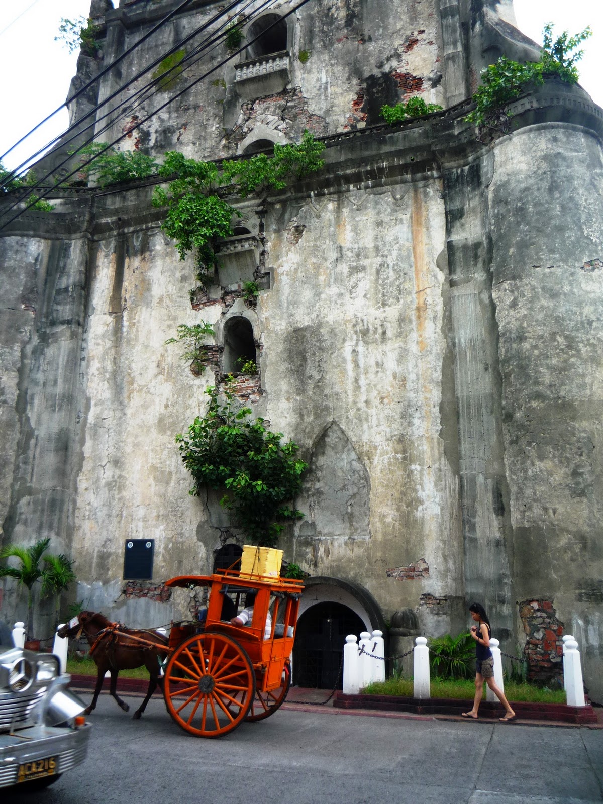
Found in the town of Paoay, approximately 470 kilometers north of Manila is Paoay Church or Saint Augustine Church.  Built in 1704 under the initiative of Augustinian priests, the church was completed in 1710, the bell tower in 1793.  The church was built of coral blocks, stucco-plastered bricks, salbot (tree sap) and lumber, bound together by mortar--a mixture of sand and lime with sugarcane juice. 

A unique combination of Gothic, baroque and oriental architecture, the style has been dubbed an "Earthquake Baroque" because of its massive 24 carved buttresses flanking the sides and rear facades.  Large coral stones were used for the lower level and bricks on the upper level--the walls are 1.67 meters thick made of the same materials (reminds me of 1.618 meters--the golden ratio, the mathematical formula for beauty :p). The builders made sure that the church would be a safe refuge that could withstand natural calamities.  A few meters away is a 3-storey coral stone bell tower.  The bell tower served as an observation post of the Katipuneros during the 1896 revolution against the Spaniards, and  by Filipino guerillas during the Japanese occupation in World War II. 

President Marcos declared Paoay Church as a national treasure and it was listed in the UNESCO World Heritage Site in 1993.

@ mirandablue

@ mirandablue
Compared to its impressive exterior,  I was surprised that the interior of the church---especially the altar, was simple and almost austere.  I was expecting a stunningly carved retablo, beautiful antique religious icons, and a painted ceiling similar to that of the Sistine Chapel.

At the doorway, we met a man (a Knights Templar, according to my sister :p) who gave us a brief history of this church, and pointed me to good vantage points to take photographs.  He said that four generations of his family have been serving this church.  Our Knights Templar confirmed that the original ceiling was indeed painted with murals but it was destroyed a long time ago.  He added  that the ceiling would soon be replaced---UNESCO gave the parish 5 million pesos (or about US$100,000) for the rehabilitation of the church and grounds.


@ mirandablue
Viewed from the right side, these giant buttresses reminded me of a Javanese temple.  
@ mirandablue
Fr. Pedro Galende, director of San Agustin Museum in Intramuros notes, "There is massiveness, movement, integration, and above all, a forceful sweep of illusion that say a great deal about Filipino ingenuity.  The result is an outstanding and undeniably Filipino type of architecture, neither Baroque or Gothic, neither European nor Mexican, but authentically Filipino."

@ mirandablue

Posted for My World-Tuesday

Sunday, October 10, 2010

Bridge along Maharlika Highway

@ mirandablue
How I wish I made some kind of a list of bridges and places of interest that we passed from Vigan to Pagudpud.  But I was the designated driver on this leg of our road trip and multi-tasking while driving is a bad idea.  So with this truss bridge, I don't know where the exact location is. But this is along the Maharlika Highway, about an hour before Pagudpud... probably after Pasuquin, Ilocos Norte, approximately 530 kilometers from Manila.  The Cordillera mountain range on the left, the South China Sea on the right.


This post is linked to Sunday Bridges

Tuesday, October 5, 2010

Cliffs of Burgos [Watery & Outdoor Wednesday]

@ mirandablue
These were taken from the top of the Kapurpurawan rock formation in Burgos, Ilocos Norte. Limestone cliffs of sedimentary rock along the coast of Burgos which are largely undefended from erosion by the sea. Facing the South China Sea, this coast yields gamet (black seaweed) from September to February, also a period when Burgos Bay is rough and the waves are swelling.  The equivalent to the Japanese nori, gamet comes as a black and flat seaweed sheet when dried.  

Gamet gatherers would wait for the waves to retreat before they start picking on the seaweeds stuck deep in the fissures of rocks and corals.  I have eaten gamet but never thought gathering it can be dangerous.  I loved these windswept cliffs, the rugged coast, this remote place.  It wasn't easy coming here but it was all worth it.

@ mirandablue
Burgos, Ilocos Norte, Philippines


This post is linked to Watery Wednesday and Outdoor Wednesday